Forget Hurricane Ophelia - is Storm Brian going to hit the North East this weekend?


Heavy rain and gusts of 50 miles per hour (mph) are expected widely across southern England and the west of Wales on Saturday and winds could reach 70mph in exposed areas.
The wild conditions, caused by a "weather bomb" over the Atlantic Ocean, may cause coastal flooding and affect transport, the Met Office said.
Advertisement
Hide AdAdvertisement
Hide AdHere in the North East, however, conditions are not expected to be so severe with winds expected to peak at around 40mph at around 1pm on Saturday.
Nor is their likely to be a repeat of Thursday's rain with the weekend weather across the region expected to be a mixture of cloudy and sunny.
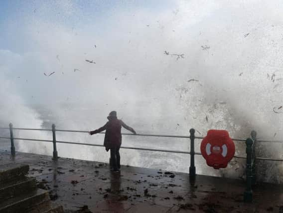
Met Office spokesman Grahame Madge said: "Dramatic waves could pose a threat to life and there will be quite hazardous conditions along the seafront."
He warned thrillseekers not to risk their safety by posing for "storm selfies" along the coast.
Advertisement
Hide AdAdvertisement
Hide AdA yellow weather warning for wind has been issued in affected areas, valid from 4am to midnight on Saturday.
While the warning covers London, gusts in Brentford for Sunderland's match at Griffin Park are not expected to exceed 45mph.
Wide parts of the country could see between 15mm and 25mm of rainfall, with deluges of up to 60mm in isolated areas.
Drivers in affected areas have been advised to reduce their speed and be prepared for sudden gusts, debris and fallen branches in the road.
Advertisement
Hide AdAdvertisement
Hide AdRAC spokesman Pete Williams said: "With the chance that high winds could coincide with the high tide - those driving on coastal roads should expect strong winds forcing spray and even waves on to the road - again proceed with caution and ensure that you have a clear view of the road ahead."
He added: "When you reach your destination consider parking safely avoiding trees, overhanging telephone wires and things which could represent a falling danger."
Alison Baptiste, the Environment Agency (EA) national flood duty manager, said: "Strong winds are expected across southern England on Friday night and into Saturday.
"Some coastal flooding is possible along the south and south-west coasts of England, especially around high tide, with large waves, spray and some over-topping of coastal defences.
Advertisement
Hide AdAdvertisement
Hide Ad"We urge people to stay safe along the coast and warn against putting yourself in unnecessary danger by taking 'storm selfies' or driving through flood water - just 30cm is enough to move your car.
"EA teams are on the ground checking defences and taking precautionary measures such as closing tidal gates."