

Hart Lane, Raby Road, Mainsforth Terrace, Burn Road and Clark Street may all be familiar Hartlepool names.
But do you remember them when they looked like this?
We have the Hartlepool Museum Service and Hartlepool Library Service for this step back in time.
So if you lived in town back in the day, take a look at a street scene which might bring back memories.
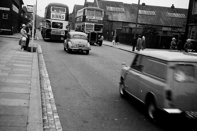
1. Raby Road
An early 1960s view showing the corner of the Chester Hotel, Gales Garage and two West Hartlepool Corporation buses. Photo: Hartlepool Library Service
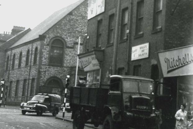
2. Hart Lane
The corner of Hart Lane and Raby Road with the now demolished Hart Road Methodist Church also in the picture. Photo: Hartlepool Library Service. Photo: Hartlepool Library Service
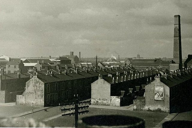
3. Burn Road
Houses at the bottom of Burn Road with Bedford Street, Seamer Street, the council destructor chimney and the tower of St Aidan's Church all in view. Photo: Hartlepool Museum Service. Photo: Hartlepool Museum Service
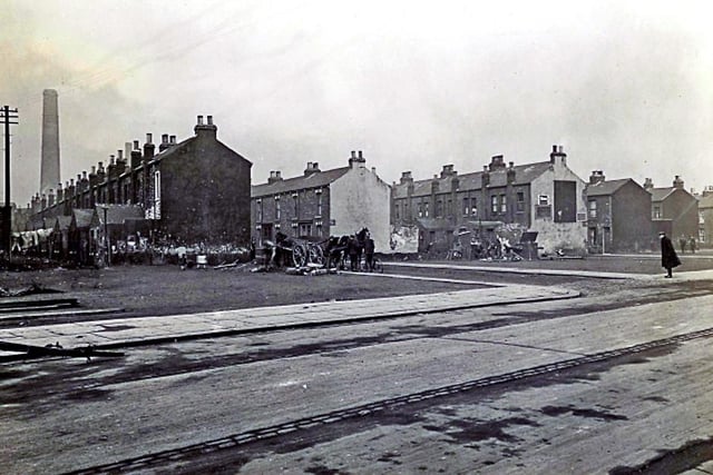
4. Bedford Street
Looking towards Bedford Street, with Seamer Street and Cromwell Street also in the picture. Photo: Hartlepool Library Service. Photo: Hartlepool Library Service